XenomatiX joins mobile mapping
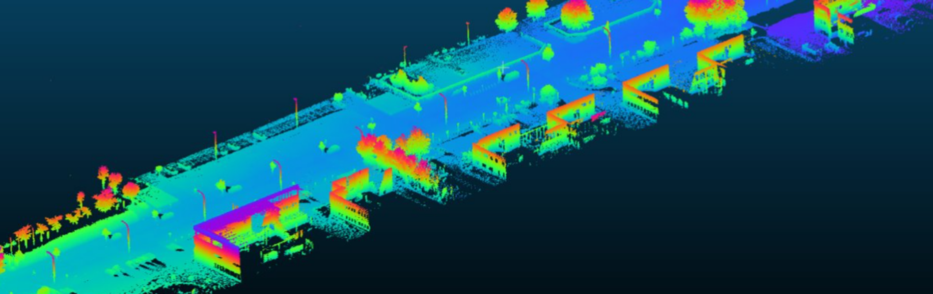
XenomatiX is reshaping the landscape of asset and infrastructure management with its newly launched product the GPC360. An integrated Lidar-GNSS system which collects geospatial data from a moving vehicle capturing detailed 3D information including location, dimensions, and spatial relationships of the surrounding environment. This extends beyond roads, encompassing infrastructure and other furniture such as traffic signs, light poles, parking spaces, power cables, vegetation, and more. Applications include inventory and asset management, environmental monitoring, urban planning, and so forth. XenomatiX enters the mobile mapping market with its GPC360, renowned for four unique propositions:
- Digital representation of the asset or infrastructure
- Precise positioning with geolocation
- Comprehensive 3D visualization for rich data insights
- Dimensional analysis of the scene to understand (relative) distances, sizes, passage, etc..


Digitizing inventories proves to be more cost-effective compared to manual approaches, while also more accurate.
The combination of Lidar and GPS provides precise geolocation of every element in the scene. This ensures that any asset in the urban or rural settings is accurately pinpointed within their respective environments, enabling stakeholders to make informed decisions with confidence based on location and dimensions. Moreover, the whole process is exceptionally straightforward, data is collected then with just a click of a button processed and visualized on a user-friendly interface within minutes.
In summary, XenomatiX facilitates stakeholders optimize existing inventories, plan for future developments, and proactively address maintenance needs, ultimately improving overall operational efficiency like they never did before.