In the coming years, the mapping of road systems throughout the world is going to become one of the most important technological fields for supporting other solutions, bringing us to the next stage of transportation. This, of course, is a process that is already underway, and while the growth of autonomous driving as a part of society at large hasn’t gone at quite the speed some anticipated, it’s still coming at some point in the relatively near future. And if they are going to fill that space as we expect, autonomous vehicles need to rely on accurate and timely roadway maps.
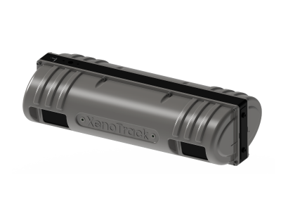
Of course, some of this mapping can and will be done in real-time, with autonomous vehicles collecting this information as they drive, but it will be important to have that base map built into the system as well. Plus, this is certainly not the only function of road mapping, something that has plenty of utility even today with nearly every car on the road being manually driven. And to that end, XenomatiX recently launched a new product to make this mapping process more efficient. At Geo Week 2023, the solid-state lidar company introduced their Dual Lane surveying solution, the latest addition to their XenoTrack product suite.
XenomatiX will be introducing this product at the end of this month for the Geo Week audience, hosting a 45-minute webinar on March 02, 2023 at 10:00 AM, covering some of the features of this new system, the concept of the company’s 6D Road Scanning, and a live demo of the Dual Lane system. Additionally, XenomatiX CEO Filip Geuens took some time recently to speak in-depth with Geo Week News about the new product, what separates it from others on the market, and how it can be used.
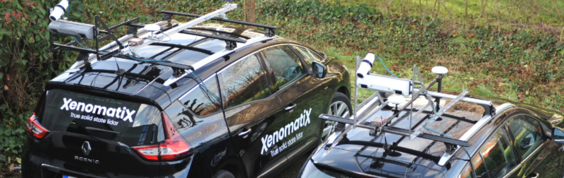
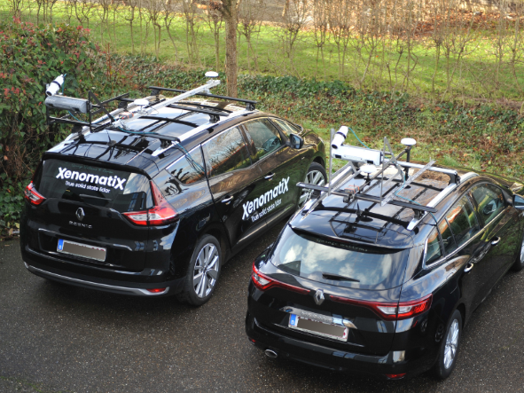
One thing that became clear from our conversation with Geuens is that simplicity of use and user-friendliness was an important feature in putting together this product. In some ways, that is inherent in the product itself, which takes a relatively simple concept – what if we could scan more of the road in one pass? – and solves the issue with advanced technological solutions. Geuens talked to us about that ease of use, saying “we’ve developed a road lidar system that can easily be fitted on any car.”
Many times for projects like the ones which will utilize this type of solution, specialized vehicles like a surveying van or truck will be needed to properly utilize the lidar system. XenomatiX’s solutions, including but not limited to the Dual Lane system, can be used for any car, saving a lot of money and hassle for the end user. Additionally, they offer their own software for the data processing, while also giving the option to simply collect the raw data from the system to use with other software.
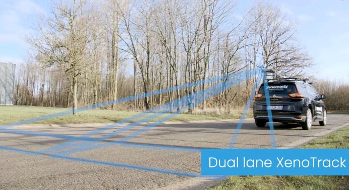
As for the actual solution itself, it comes down to maximizing the efficiency of a road mapping project. Just as the name suggests, at its core it is quite simple as the lidar system enables a surveyor to capture two lanes in one pass rather than the traditional one. The hardware connects to the back of a vehicle, which allows for the sensor to more closely follow the car’s trajectory as compared to scanning from the front of the vehicle.
Really, though, the separating factor for this system compared to other laser-based scanning systems for road mapping is the multibeam process. XenomatiX was the first company to introduce multibeam lidar systems, and it’s something they are carrying into this system. This, Geuens says, is the big reason they are able to come out with this solution, which sends out 28,000 laser beams simultaneously. It’s not as though the idea of scanning multiple lanes at the same time to increase efficiency was an out-there idea, but this kind of scanning technology made it possible.
Geuens further explained where the industry had been, and how XenomatiX is helping take it to the next level. He noted that the industry was on “the wrong track” before, relying on high-resolution cameras rather than laser scanning. The resolution was great, but that methodology prevented getting accurate dimensions. That said, those using laser scanning were using single-beam solutions, which was extremely precise but lacked the resolution needed without stacking data from multiple individual beams. Here, just a single shot from the multibeam can cover the entire area, and “because it’s in one shot, there’s no influence from the motion of the vehicle.”
At the top of this article, we talked about the importance of this road mapping with the burgeoning market for autonomous vehicles, and Geuens agrees that this is clearly top of mind for anyone in the industry. That said, he noted other use cases that benefit from this technology as well. For one thing, sticking with the autonomous vehicle market, XenomatiX products have long been used by manufacturers to ensure their suspension systems are still working properly.
Additionally, he mentions the use case for a town or department of transportation in a wintry area. Anyone who has ever lived in this type of locale knows that roads often get beat up during the winter months. Those areas can benefit from this technology, allowing them to digitize these roads and find potential issues that need to be repaired much more efficiently. It’s important for road safety to find these problem areas as quickly as possible, and being able to cover multiple lanes with XenomatiX’s new solution significantly speeds up a project, one that could feasibly cover thousands of kilometers of highway.