Septentrio & XenomatiX
Eric van Rees, writing in Geo Week News, explored how XenomatiX plans to use a compact GNSS/INS receiver from Septentrio for its 6D Road Scanning and Survey solutions.
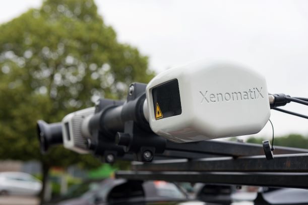
The article notes: ”When measuring among road sections, all measurement data must be stitched together to create a complete and correct model, excluding drift and missing data. The combination of a very productive, lane-wide road scanner from XenomatiX and precise and reliable GNSS/IMU from Septentrio allows for creating such accurate road models…. The GNSS/IMU is synchronized with the lidar system, which means that every measurement consists of synchronized lidar data, GNSS data and car body movement data. Advanced mapping algorithms use these inputs for very precise SLAM and stitching.”
Eric goes on to explain XenomatiX’ sensor fusion algorithms: ”XenomatiX’ sensor fusion algorithms combine visual SLAM techniques with GNSS, IMU and CAN to obtain a seamless map of the road shape. …Combining lidar, CAN-data and GNSS/INS data allows to turn the road measurement into a very precise overall digital model expressed in a global coordinate system.”
Other media covering the partnership news included GPS World