Road Scanning and Surveys
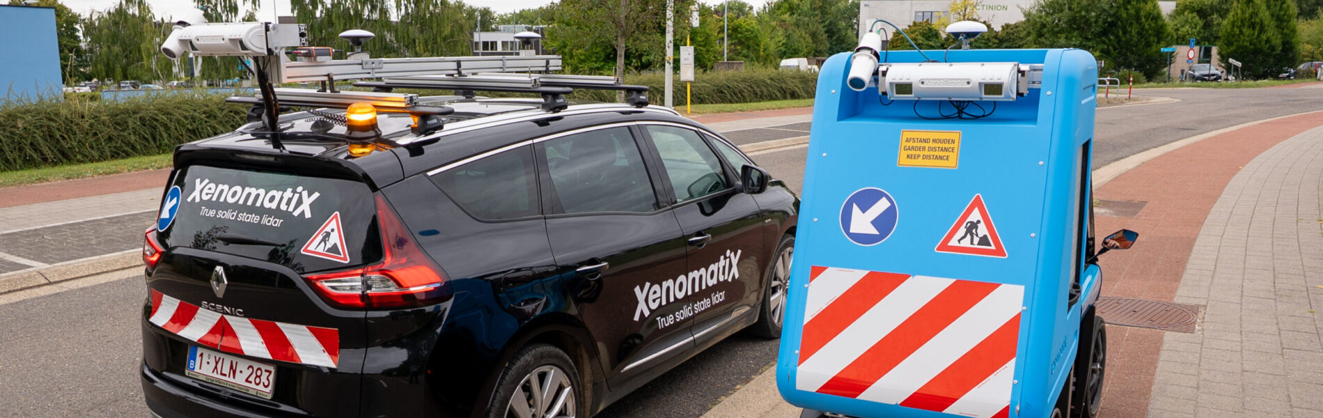
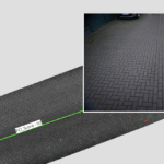
XenomatiX pioneered 6D road scanning as an innovative alternative to traditional methods of pavement inspection, combining high-precision detection, accurate geo-referencing, and AI-powered processing. With costs five times lower than conventional equipments— XenoTrack technology generates a complete 6D geometry of the road, including road markings
• 3D digital representation of the road surface
• 3D reflectivity measurements to segment the road markings and their quality
• 2D images with AI analysis, captured simultaneously
• Precise geolocation and seamless integration in GIS
With its portability and ease of integration, XenoTrack enables road assessments anywhere. It can be mounted on vans, cars, bikes, or even railways—adapting to your needs so you can deliver fast and precise pavement inspections wherever you go.
Request Data SampleHow easy is it assess pavement conditions?
It is easy and quick to collect pavement data with XenoTrack, 6D road lidar.
- XenoTrack can be set up in only 45 minutes on any vehicle.
- XenoTrack comes in two versions: single lane and dual lane. The dual lane version measures up to two lanes simultaneously.
- Only one driver is needed to collect the data.
- At high driving speeds, or at night data collection remains highly accurate.
- Road quality indices, cracks, and potholes are calculated on board.
- Georeferenced digital representation of the road surface is provided.
- Data is processed within a few hours and imported into any GIS system.
- Road sections and cracks are analyzed to determine the PCI.
- Reports can be downloaded in PDF and Excel formats.
XenoTrack is certified by AASHTO

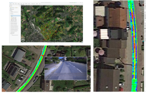
Road Quality Indices
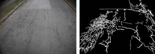
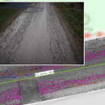
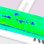
XenoTrack road lidar calculates the IRI, MPD, Rutting and Pavement Condition Index (PCI) while performing the road survey data collection. After data collection, the quality indices are readily available to upload to your GIS. A GIS system is then used to combine and relate the information of 2D pictures, 3D geometric twin, road markings and quality indices, and show the quality analyses on a streetmap visualization. Every crack and potholes are also identified based on edge AI technology.
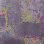
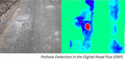
Cracks and Potholes
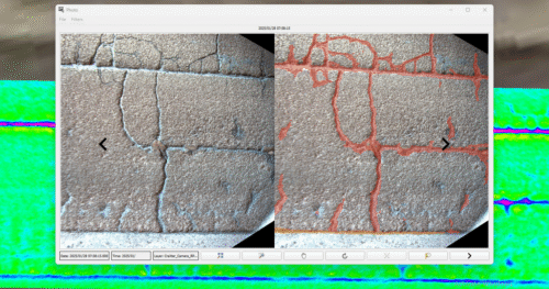
The crack module fuses high-resolution camera imagery with 3D spatial data to capture accurate, high-resolution digital representation of the road surface. Once the data is captured, XenomatiX applies its edge-AI-powered detection algorithms to analyze the road condition, automatically recognizing and classifying cracks while effectively filtering out irrelevant visual obstructions, such as shadows or lane markings. XenomatiX also measures potholes dimensions, providing precise data on area, volume, depth, and severity, in all lighting conditions, accurately detecting and classifying potholes even on rough or damaged roads.
Results
The resulting data includes color-coded crack mapping, with colors representing the severeness of the cracks and hence the priority to repair. Besides the severity, also the density is calculated, indicating the percentage of the surface that is affecting the road foundation. XLSX and PDF reports are automatically generated with an overview on all indexes and distresses linked to each street giving a clear, actionable overview.
Post-processing and Analyses
- Cracks, Raveling, Patches, Faulting, Potholes
- International roughness index (IRI), Pavement Condition Index (PCI), Rutting
- Longitudinal and transversal evenness
- Road markings – Available On-Demand
- Subsidence – Available On-demand
Features and Capabilities
- High-Precision Crack Detection – detects all types of road distress from minor surface fractures to extensive alligator cracking.
- Edge–AI-Powered Processing – AI models ensure reliable results.
- 3D + 2D Data Integration – laser based measurements
- Automated Severity Classification – crack width and depth are analyzed to classify defects based on severity levels.
- Automated Density Reporting – crack surface coverage is reported to complement for warning of road foundation degradation risk.
- Accurate RTK Georeferencing – overlaid onto interactive GIS maps for easy visualization.
- Robust Performance in Complex Environments – even under shadows, surface textures, and low light.
XenomatiX allowed us to visualize the IRI on a Google map and classify roads and tracks fast and easy with a very good correlation to the subjective findings of our certified drivers.
XenomatiX’ road data convinced logistics companies in the Antwerp harbor of the power of LiDAR in continuous quay quality management, with the perspective to deploy an autonomous health and safety system for their manpower.
The R&D partnership between BRRC and XenomatiX focuses on affordable solutions for smaller road network owners that aim for performant and cost-effective road management. We also focus on exploring the tight link between road data infrastructure to autonomous vehicles of the near future.
We receive data for every cm² of Leuven’s streets. The data is visualized on a GIS system and colour coded, this instantly enables our team to assess the exact condition of the road surface. Additionally to the 3D map, XenomatiX provides 2D images of the road surface, so that no road distress remains unnoticed
‘’XenomatiX’ systematic approach has provided us with clear and actionable insights into the condition of our roads. We appreciate the simplicity and effectiveness of their system.’’
“We can work in a very efficient and structured way. This system (XenoTrack) clearly shows us which roads require immediate attention and the budget needed for repairs. Additionally, residents will have a better understanding of the condition of their streets.”