GPC360
Precision Geo-Mapping
The GPC360 uses a lidar system integrated with GNSS technology, designed to gather geospatial data while in motion from a vehicle. It captures comprehensive 3D information, including precise location, dimensions, and spatial relationships of the surrounding environment. It maps the surrounding environment from road infrastructure such as traffic signs, light poles, parking spaces, power cables to vegetation, and more.
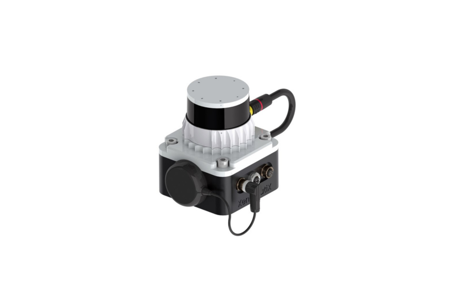
The system is an integrated solution encompassing both hardware and software. It facilitates onboard data capture and storage, providing the necessary tools for real-time recording of environmental information. Moreover, its software offers offline functionalities for the meticulous creation of highly accurate geo-referenced digital models of the 360-degree environment. Check out the live demo here
- Output: X,Y,Z, Reflectivity plus GPS location.
- Resolution: 1024 x 64 points per frame
- Range: 100m for 80% reflectivity at 100klux
- Accuracy: 2,5 cm
- FoV: 360° x 45°
- Cost effective mobile mapping kit
- Compact All-in-One unit
- Easy installation
- Pre-aligned Lidar/GNSS
- Self-alignment in world coordinates
- Suitable for any vehicle
- Precise correction for vehicle ego-motion