Reading Road Markings
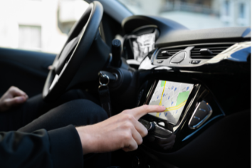
Acceptance of self-driving cars by other road users will strongly depend on how well these cars stay in the right lane. Maybe not so difficult in straight driving, but many accidents with level 2 cars happened on road forks and junctions where road markings create confusion.
This is well understood by mapping and navigation companies. Serious efforts are being done to create high-definition maps, containing the entire road infrastructure, up to every single road marking dash.
On-board cameras can see road markings, but precisely locating these road markings in geo-coordinates is very difficult for this camera. Assume the car has access to maps with road marking locations, precise to the centimeter. Current GNSS systems allow the car to know its position with the same precision. Combining the two, the precise road markings can be used to set and monitor the absolute trajectory the car must follow, even when adverse weather or low ambient light prevents the car from seeing the road markings.
The accurately geo-located road markings will act as beacons to keep the car in (the right) lane. Positioning the car precisely relative to the ‘surrounding’ road markings will assure other road users trust the self-driving car as it is well-positioning in its lane. Clearly, the onboard camera will assist as much as possible, but the HD maps make it way safer.
Then, how to accurately locate existing road markings?
There are tons of camera recordings in which the markings are visible, but image distortion, viewing angle, lack of depth information, and lack of precise camera alignment do not give this data sufficient accuracy. Moreover, camera localization is purely dependent on high-accuracy GNNS systems. Where GNSS signal is poor, like in city canyons, the absolute accuracy decreases, requiring corrections and postprocessing with increased complexity resulting in additional costs, time, and possible errors.
The solution comes from road LiDAR. LiDAR is a 3D sensor capable of determining the exact location of detected objects. Road markings are also objects a road LiDAR can detect, based on its ability to measure reflectivity. LiDARs emit laser light. They know how much they emit and they measure how many returns. In this way, relative and absolute reflectivity can be quantified. Since road markings return more light than asphalt or concrete, road markings are well visible in LiDAR pointclouds. When digitizing road markings with high resolution, their shape and location can be extracted from the LiDAR data. The 3D location of the road marking is measured in the LiDAR coordinate system.
Since the LiDAR, thanks to an innovative SLAM (Simultaneous Localization and Mapping) algorithm, can calculate with mm accuracy of the vehicle trajectory, it can also compensate for the GNSS errors. The absolute location of the LiDAR coordinate system in the earth coordinate system is then established during driving. As a result, also the location of the road markings in the absolute earth coordinate system is revealed.
With this road marking localization solution, XenomatiX helps navigation companies to make their image databases much more accurate. This is done as follows. As explained above, road LiDAR delivers the absolute location of road markings in earth coordinates. If the same road marking is present in camera images, these pixels in the image can be given absolute earth coordinates, coming from the corresponding LiDAR data. By doing so, the entire picture database and the features extracted from these pictures can be given more precise absolute position data.
This does not require re-measuring all roads with the road LiDAR. Establishing reference values for some road markings on some roads makes it possible to calibrate large amounts of camera data based on a few LiDAR data.
The direct approach is of course to put road LiDAR on mapping vehicles and to collect data for HD maps directly with both cameras and road LiDAR.
